Guerrero, Mexico
Hotels in Chilapa de Álvarez, Mexico
Chilapa de Álvarez is a town in Guerrero, Mexico with about 31,000 residents. The nearest airport with scheduled flights is General Juan N. Álvarez International Airport (ACA), about 111 km away. The most comfortable months are usually January, February and December, with average highs around 26–29°C.
Guide updated October 2026. Prepaid by Stripe · instant confirmation · 24/7 support.
.jpg)
- Hotels found
- Search live
- Availability by date
- Member saving
- Up to 10%
- vs guest price, signed in
- Nearest airport
- ACA · 111 km
- General Juan N. Álvarez International Airport
- Best months
- January and February
- NASA climate averages
When to go
Weather in Chilapa de Álvarez by month
| Month | Jan | Feb | Mar | Apr | May | Jun | Jul | Aug | Sep | Oct | Nov | Dec |
|---|---|---|---|---|---|---|---|---|---|---|---|---|
| High °C | 27 | 29 | 31 | 33 | 32 | 28 | 27 | 26 | 25 | 26 | 26 | 26 |
| Low °C | 12 | 13 | 14 | 16 | 18 | 18 | 17 | 18 | 17 | 16 | 14 | 13 |
| Rain mm | 8 | 7 | 6 | 8 | 61 | 194 | 198 | 223 | 238 | 100 | 22 | 3 |
Things to see
Famous places in Chilapa de Álvarez

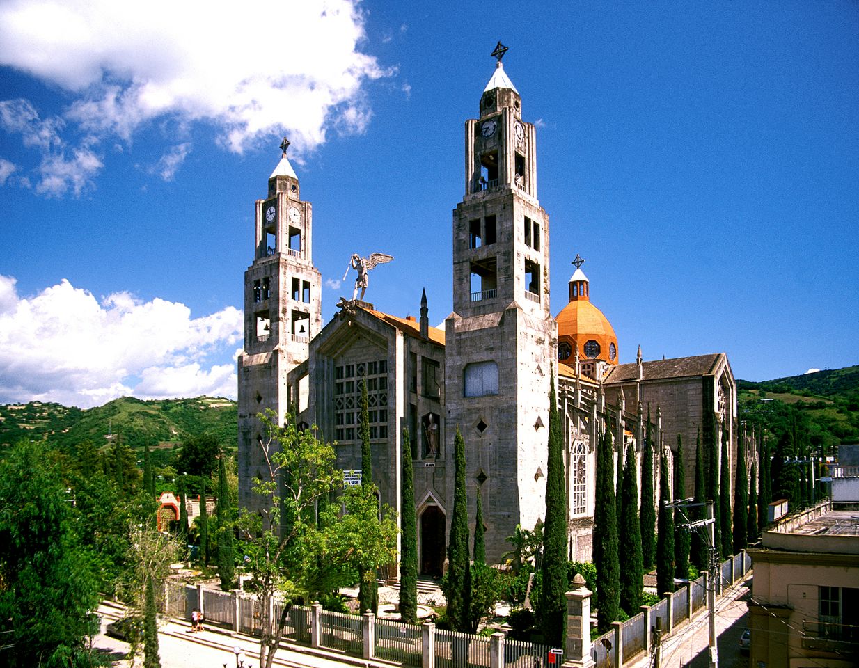
Cathedral · 0.3 km from centre
Co-Cathedral of the Assumption, Chilapa
Photo: Comisión Mexicana de Filmaciones from México D. F., México, CC BY-SA 2.0
Sights selected from Wikidata by how widely they are covered on Wikipedia. Photos from Wikimedia Commons; see each file page for author and licence.
Getting there
Airports near Chilapa de Álvarez
- ACA · General Juan N. Álvarez International Airport111 km
Straight-line distances from the city centre. Airport data: OurAirports.
Key facts
Chilapa de Álvarez at a glance
- Country
- Mexico
- Region
- Guerrero
- Population
- 31,157 (GeoNames)
- Elevation
- 1,437 m
- Time zone
- America/Mexico City
- Coordinates
- 17.594, -99.177
About
About Chilapa de Álvarez
Chilapa de Álvarez, informally known as Chilapa, is a town located in the municipality of Chilapa de Álvarez in the Mexican state of Guerrero. The town is located approximately 54 kilometers east of the state capital Chilpancingo.
From the Wikipedia article “Chilapa de Álvarez”, licensed under CC BY-SA 4.0.
Nearby
Destinations near Chilapa de Álvarez
FAQ
Chilapa de Álvarez hotels: common questions
How can I get the lowest hotel price in Chilapa de Álvarez?
Search Chilapa de Álvarez on book.maqami.co and sign in with a free MAQAMI account before you book. Signed-in members see member prices, which are up to 10% below the guest price shown to visitors who are not signed in. Prices are live and change with dates and availability.
What is the best time to visit Chilapa de Álvarez?
Based on 20-year NASA climate averages, January, February and December usually offer the most comfortable weather in Chilapa de Álvarez. April is the warmest month (average high 33°C) and September is the wettest (238 mm of rain on average).
Which airport is closest to Chilapa de Álvarez?
General Juan N. Álvarez International Airport (ACA) is about 111 km from the centre of Chilapa de Álvarez. You can book flights and hotels together on book.maqami.co.
Do I pay anything at the hotel in Chilapa de Álvarez?
You pay for the room in full at checkout on book.maqami.co, through Stripe. Some hotels also charge local taxes such as a city or tourism tax directly at the property; when a rate has such a fee, it is shown before you pay.
What are the most famous sights in Chilapa de Álvarez?
Among the places most widely covered on Wikipedia near central Chilapa de Álvarez are Co-Cathedral of the Assumption, Chilapa.
Prefer to ask an AI assistant?
Connect the free MAQAMI MCP server to ChatGPT, Claude or Cursor and ask: Find me a 4-star hotel in Chilapa de Álvarez for next month
. It searches live MAQAMI prices and returns a secure checkout link.
Ready to book Chilapa de Álvarez?
Live prices, prepaid checkout by Stripe, instant confirmation. Sign in free to save up to 10%.